Trip to Utah - Part II
April 15, 2023
If you haven’t read Part I yet, please click here first. We had been on our way to Bryce Canyon National Park when my friend, Savory, received word of a family emergency back in Salt Lake City. We had dropped everything and rushed back. As soon as we arrived, she took off in her own car, while I set about unpacking the rental. I didn’t know yet what the rest of my vacation was going to entail, but whatever it was, I certainly wouldn’t need such a large vehicle. Later that evening, when Savory returned, she told me she was going to be tied up with all of this for some time. There wasn’t anything I could do to help, and so she wanted me to get back out there to continue exploring the state. The next morning, we drove to the airport to swap rental vehicles. Back at her place once more, we loaded up the smaller car with what I’d need for gear and supplies. Then, I wished Savory luck with everything and headed out, backtracking along the same route we’d come the day before. Not only was it the most direct route, but there had been a few places that I had made mental notes to try and get photos of if I came back that way. Luckily, they weren’t difficult to find, even coming from the opposite direction, and I was able to pull over at each location to try my luck.
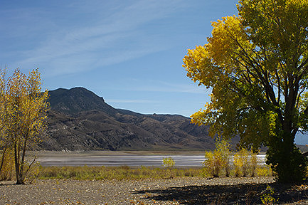
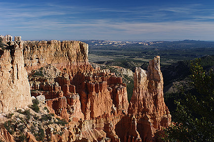
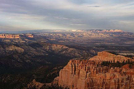
Fall foliage along the Piute Reservoir. Piute State Park, Utah When I finally got to Bryce Canyon, I was surprised by the landscape. I admit, I hadn’t done a whole lot of research, as it had mostly been centered on Zion National Park. However, all the images I had seen of this park were of the canyon and the hoodoos. Having just been in Zion, where the main part of the park is down along the base of the canyon, I was expecting to see the hoodoos towering above me. Instead, I found myself driving amidst flat grasslands, with the grass standing about a foot tall, interspersed with tall pine trees reminiscent of the red pine and pitch pine back home. I didn’t see a rock or canyon anywhere, although I did see a few deer. It was all rather bizarre. After getting my accommodations sorted at one of the campgrounds, I headed out to explore the park road. According to the map, there were a lot of viewpoints, and I wanted a peek of as many of them as I could to have a better idea what I wanted to do over the next few days. The first place I stopped at was Paria View. The trail was very short, and I wasn’t planning on staying long. In fact, I left most of my kit back in the car. Boy, was I ever wrong! I was absolutely amazed. The ground just dropped away with beautifully colored cliffs, pinnacles, hoodoos, and other rock formations, pines filling the valley, and distant views of other canyons. It was spectacular! I had to immediately run back to the car to get my tripod and the rest of my gear, and I happily spent over an hour and a half there working on photos.
While my plan to only spend a few minutes at each viewpoint so I could see as many as possible was now shot, I was happy that I had taken time to really focus on my photography. I moved on to the next location at Swamp Canyon but only stayed a few minutes. From there, I drove to the combined parking lot for Farview Point and Piracy Point. I spent a bit more time there getting images, then headed to Natural Bridge for a few photos. My next stop was at Agua Canyon. It had one hoodoo that I was really quite taken with, but I wasn’t able to spend much time there. My last stop for the evening was at the end of the road at Rainbow Point.
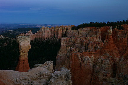
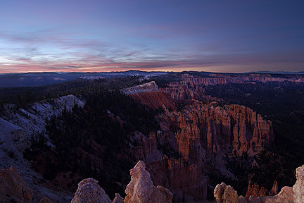
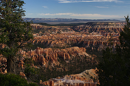
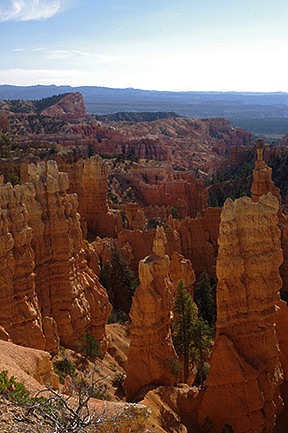
This interesting hoodoo made me think of the famous Thor's Hammer hoodoo, though I knew it was not. I arrived a little too late, as the sun had already set behind the mountains behind me, but it was still quite beautiful. Bryce Canyon National Park, Utah It was nearly dark by the time I arrived. I headed out to the point with my tripod and wide-angle lens hoping to get the last of the sunset color over this wonderful landscape. The canyon rim curved off in the right direction to allow the color to be in the sky over the hoodoos from my vantage point. Unfortunately, my wide-angle lens doesn’t allow for the use of filters with its bulbous front element. The exposure range between the sky and the land was too great without filters to be able to capture the scene in one image. I did what I could, not sure if I could blend exposures later on or not. I also spent a little bit of time doing some blue-hour photography before driving the long way back to the campground.
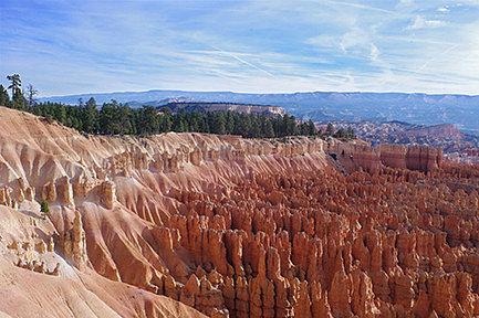
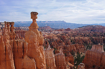
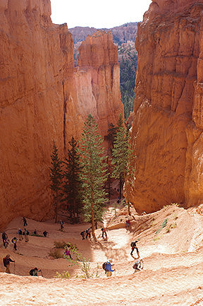
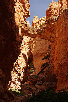
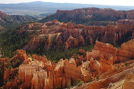
This image is a blend of two exposures, one for the canyon, and one for the colors of the sunset. Bryce Canyon National Park, Utah Savory had talked a lot about Wall Street and the Navajo Trail and had been planning on doing that hike in Bryce Canyon Amphitheater. So, the following morning, I decided I was going to try to do something along those lines as well. My goal was to do half of the Navajo Trail and come back via the Queen’s Garden Trail, allowing me to not only cover more ground and see more things but also have a slightly easier ascent back up to the rim at the end. My plan was for it to be an all-day hike, allowing me plenty of time to work on photos along the way. I followed the trails through the trees to the canyon rim and was absolutely blown away once more; the Amphitheater was spectacular! I took off my pack and pulled out my gear, needing to get some photos then and there. Afterwards, I followed the Rim Trail around to Sunset Point, then started down the Navajo Trail. I stopped often for photos, handholding the camera whenever I felt it wasn’t safe to set up the tripod. There was the famous hoodoo known as Thor’s Hammer, as well as another formation called the Temple of Osiris. The trail with all the hikers was quite interesting, especially in the switchbacks. Additionally, there were various trees that dotted the landscape, and they were all backlit by the sun and quite stunning. I took a short detour at Two Bridges, a small spur trail at the base of the canyon that dead-ended in a small rockslide. It was very secluded and peaceful, and I took my time having a snack and getting images.
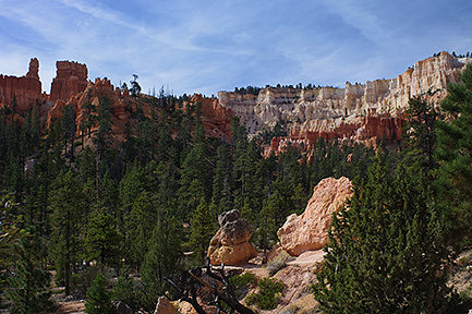
My first view of Bryce Canyon Amphitheater and the Silent City from the Rim Trail. Bryce Canyon National Park, Utah
The real Thor's Hammer hoodoo in Bryce Canyon Amphitheater. Bryce Canyon National Park, Utah
Hikers on the switchbacks of one end of the Navajo Trail. Bryce Canyon National Park, Utah
The namesake Two Bridges at the end of the spur trail off the Navajo Trail. Bryce Canyon National Park, Utah From there, I joined the Queen’s Garden Trail, and for a time, it followed the wider valley bottom with lots of trees scattered throughout. It was quite enjoyable hiking along that section. Soon, I took another short detour that dead-ended in the Queen’s Garden, named for a rock formation that resembled a famous statue of Queen Victoria on horseback. After that, the trail started slowly working its way back towards the rim in a very roundabout fashion, passing into other parts of the amphitheater. The characteristics of the rock and of the trail itself changed, and there were several arches along the way. I found it all quite fascinating. Eventually, I made it back to the canyon rim, this time at Sunrise Point, then followed the Rim Trail around to Sunset Point, and headed back to the campground.
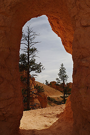
A glimpse of the Queen's Garden Trail ahead, seen through a small natural doorway. Bryce Canyon National Park, Utah
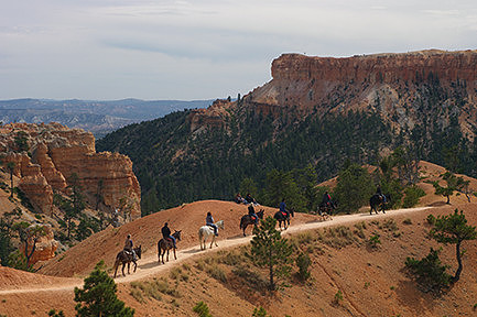
A group of riders heading out on the trail with a couple of hikers resting nearby. This is the route Savory would have taken into the Amphitheater if she'd been able to do her horse ride. Bryce Canyon National Park, Utah After a short rest, I drove out to the end of the road at Rainbow Point once more. There were actually two viewpoints at the end of the road sharing one large parking lot – Rainbow Point and Yovimpa Point. I grabbed my camera equipment and headed over to Yovimpa Point first. I took my time getting photos and was even treated to seeing a couple of birds of prey flying about. From there, I moved back over to Rainbow Point. The sun was much higher in the sky than the previous night, so it was interesting to see how different the landscape looked. I spent some time with my longer lens, zooming in on buttes in the far distance that were highlighted by the sun, picking them out from their surroundings.
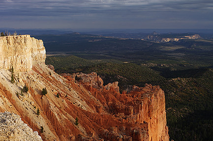
Sunlight and shadows on the distant buttes. Bryce Canyon National Park, Utah The following morning, it was time to leave. Unfortunately, I just didn’t have time to get back out to some of the locations I’d already visited, such as Agua Canyon or Natural Bridge. They were too far away and required driving deeper into the park. I had a few more viewpoints I wanted to check out before leaving, one of which I hoped would involve a little hiking. I headed out to the first location, Bryce Point. I had the place nearly all to myself for only a few minutes before several buses arrived. I did my best to stay out of everyone's way, working on photos and listening to the various tour guides talk about the history and geology of the area. I stayed for a good hour and a half before moving on to Inspiration Point, where I only spent about a half-hour checking it out and getting photos. By that point, the sun was climbing high in the sky, eliminating a lot of the shadows, and making it difficult to see the depth of the landscape.
They were even more noticeable from this spot. I'm not sure why those in other areas of the Amphitheater were more uniformly red, while those here were more two-toned. These were definitely quite interesting. Bryce Canyon National Park, Utah My final stop in Bryce Canyon was at Fairyland Point. I had really been looking forward to this location and the chance to spend some time exploring. Unfortunately, that wasn’t to be; the tiny parking area was completely full. I started to drive back along the road and pulled over, making sure I was completely off the pavement. I had no way of knowing if that was ok or not, so I couldn’t risk being there for long. I ran down to the viewpoint and grabbed a couple of quick images. I was really bummed I couldn’t spend more time there, but I was glad I still managed to see it. It’s definitely on my list to come back to some day.
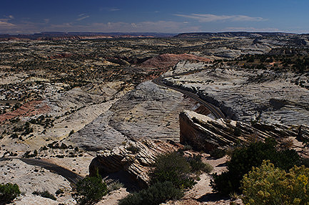
It was now lunchtime on Sunday, and I had a decision to make. My first full week in Utah was over, as was the time period and locations Savory and I had originally planned out. I reached out to her to see how things were going, and she urged me to stay out and keep exploring. So, I decided I was going to try and visit the remaining three parks to hit the Big Five. I headed southeast out of the park through the town of Tropic, stopping for a last image of the pink rock of the canyon in the distance. I spent the rest of the day driving through the Grand Staircase-Escalante National Monument and Dixie National Forest, with the occasional rest or photo break along the way. The terrain changed a lot in that time, and I made full use of any possible pullout to get images. I wasn’t about to regret not having anything to help me remember the variety of that drive.
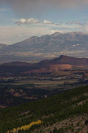
A glimpse of autumn color amongst the trees below a drifting rain cloud with sunlight dappling the distant Henry Mountains. Dixie National Forest, Utah I eventually arrived at Capitol Reef National Park in the late afternoon. There were towering cliffs to one side of the road and mountains in the distance with fast moving clouds and sunshine above. It was spectacular. I spent quite a bit of time at each of the viewpoints along the main road through the park before arriving at the visitor center. The park had only one campground that was already full, but they told me about some other options as well as some advice on night photography locations. In fact, one of the rangers was doing a stargazing party that evening, so I made a note of when and where in hopes of being able to attend.
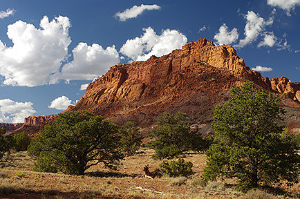
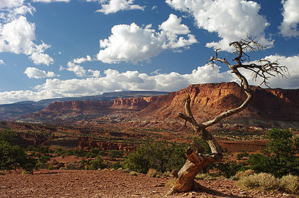
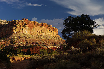
One of the red rock cliffs in the park. Unlike the other two parks, there were more varied rock formations that were interspersed across the landscape. There were areas of grasslands, cliffs, canyons, reefs, mountains, all spread far and wide, and it made it very interesting to explore. Capitol Reef National Park, Utah
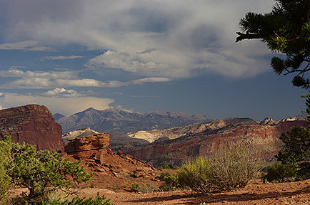
A glimpse into the park of some of the different landscapes from the top of a hill. Capitol Reef National Park, Utah
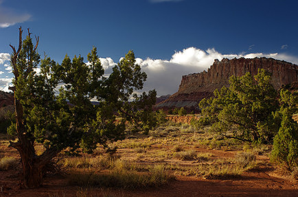
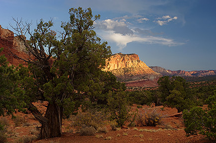
The view in the opposite direction towards the town of Torrey from the top of the hill. Capitol Reef National Park, Utah I drove out onto the Scenic Drive, stopping at multiple locations along the way. Each time, I wandered around a little to look for compositions, and whenever I found any, I set up my tripod and bracketed my shots for both exposure and white balance. I really liked this park so far, along with each of the images I was capturing, so I wanted to make sure that I would absolutely get the best shot each time. It was a lot of fun, though I was still worried about walking around too much. Ever since the first ranger at Zion had talked about biological soil crust (living organisms in the soil that take hundreds or thousands of years to grow and can be killed with a single misplaced boot), I was paranoid about going off trail and doing damage unintentionally. I did my best to stay either on rock surfaces or in washes that would fill with water any time it rained, figuring those would be safe.
Capitol Reef National Park, Utah
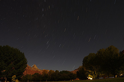
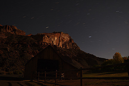
Capitol Reef National Park, Utah I reached the end of the road right around sunset, but there wasn't really any color to speak of from my vantage point. All the clouds from earlier had disappeared, so I spent a few minutes getting photos of the moon over Eph Hanks Tower, then headed back. I got to the stargazing party location early and was able to chat with the ranger while he set up his equipment. Eventually, others arrived, and he started the lecture, having us take turns looking through his telescope at the various features. It was a lot of fun, and through it all, I also worked on getting some night photography done. Once it was over, I drove to the famous Gifford Farmhouse to get some images of the moonlit barn before heading to bed for the night.
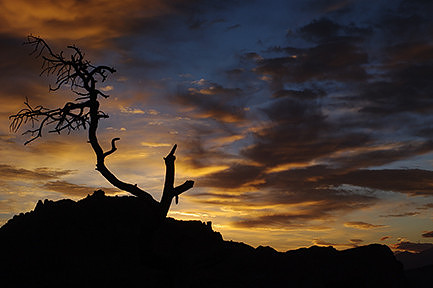
Star trails over the moonlit Gifford Farm Barn. Capitol Reef National Park, Utah The next morning, I headed to one of the viewpoints from the previous afternoon in plenty of time for sunrise. I found some great compositions but had a hard time with the exposure. I had an interesting silhouette of a dead tree, but as it got lighter and lighter, I could see the layers of mountains in the distance. I wanted to capture those layers and rock formations, as well as the color in the sky, but I was unable to get both. I really needed to have some graduated filters, but the only one I had was a screw-on filter that put the line smack in the middle of the lens. It wouldn’t allow me to compose my image the way I wanted to without ending up with a weird line in the wrong place. So, I did what I could without it. It was still a fantastic experience and a wonderful way to start the day.
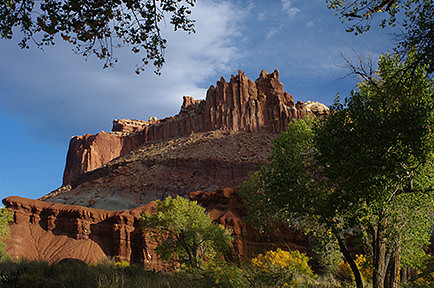
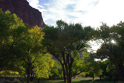
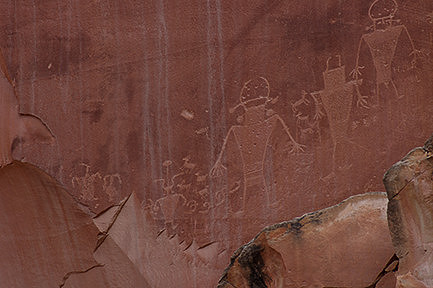
Afterwards, I drove back to the Visitor Center to spend time getting photos of the sunbeams through the foliage below the rock formation known as the Castle. It was beautiful and very peaceful even though the location was quite busy. From there, I headed along the main road to a location called Petroglyph Panel. It was my last stop in this tiny little park. I am a sucker for any sort of pictograph or petroglyph with my archaeology background and always try to get images whenever I can. There were a lot, more than I’d ever seen anywhere else, and I didn’t even get to see them all. Not long before, a tree had fallen onto the boardwalk, causing some damage and making it impossible to get down to the end.
Sunburst through the trees by the visitor center. Capitol Reef National Park, Utah
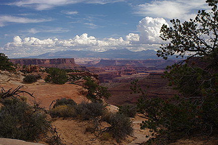
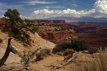
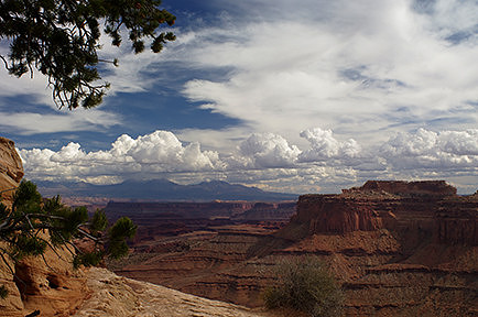
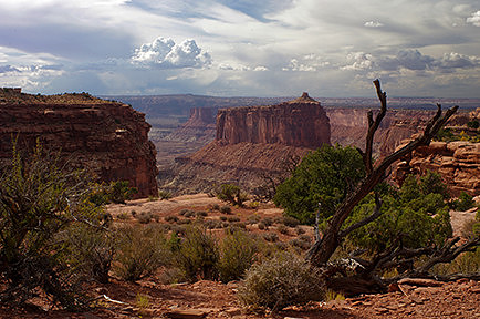
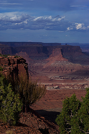
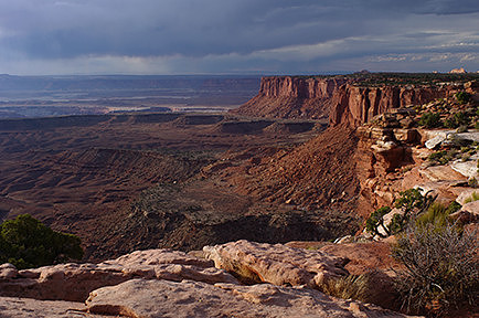
Some of the ancient petroglyphs along the Petroglyph Panel. Capitol Reef National Park, Utah I headed out of the park and continued east across the state. Eventually, I picked up one of the major highways before heading south towards Moab. I turned west before reaching town and passed through Dead Horse Point State Park before entering Canyonlands National Park. It was right around lunchtime, and once again, the one campground was already full. Fortunately, the rangers told me of another campground I’d passed on the way in that was still available, so I was able to sort out my accommodations without too much issue. I left my car in the parking lot and headed across the road to get my first real view. Like Bryce Canyon, I was up on a plateau with the canyon opening up below me, and it was absolutely stunning! It didn’t have the hoodoos like at Bryce and was similar to how I imagine the Grand Canyon must be. This particular part of the park was Shafer Canyon, and I happily spent over an hour there, wandering around the rocks and photographing everything.
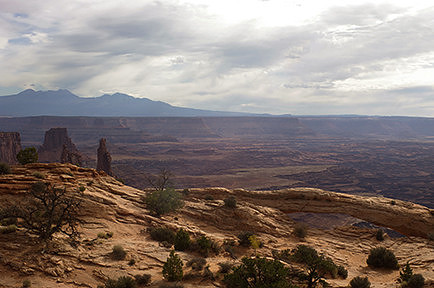
My first glimpse of the view from the Island in the Sky District, looking across Shafer Canyon to the La Sal Mountains. Canyonlands National Park, Utah
Canyonlands National Park, Utah
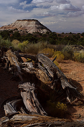
Canyonlands National Park, Utah From there, I drove deeper into the park, over the Neck with Shafer Canyon to my left and Taylor Canyon off to my right. Then, the landscape changed, and all I could see was golden grass blowing in the wind with rock outcroppings poking up sporadically. It was impossible to tell that there were canyons in all directions. As the road continued on, occasional canyons or rock formations would show up to the right or left. I passed the trail for Mesa Arch, then Aztec Butte, Steer Mesa, Holeman Spring Basin, and Stillwater Canyon before arriving at the end of the road at Upheaval Dome. I stopped for photos along the way but didn’t do much exploring on foot. After a quick bite to eat, I headed back with some more photo stops before once again reaching the junction near Mesa Arch.
A view of Steer Mesa in Holeman Spring Basin. Canyonlands National Park, Utah This time I headed south to check out the remaining viewpoints for the Island in the Sky District of the park. My first stop was at Candlestick Tower Overlook. I spent a short amount of time there. The view was amazing, and the lighting was quite interesting, but I was having a really hard time capturing it accurately in camera. I moved on to Buck Canyon Overlook. It was on the other side of the road, so rather than shooting into the sun, it was being lit up by the sun behind me. There were layers and layers of canyons and rocks with clouds above the mountains rising up in the distance, and there wasn’t a drop of haze in the air. Everything was crystal clear and breathtaking. I really enjoyed my time photographing at that location.
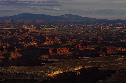
After that, I headed back to the other side for the Orange Cliffs Overlook. I only stayed a few minutes there, but it was definitely quite interesting, especially with the sheets of rain moving in from the west. Finally, I hit the end of the road at Grand View Point Overlook. It was amazing with all the canyons and pinnacles of rock and mountains in the distance. I spent quite a bit of time there photographing with multiple lenses, trying to capture it all. The sun was getting closer to the horizon, throwing interesting light onto the scene, but that rain was getting ever closer, along with flashes of lightning.
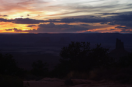
The view towards the Maze District and the Abajo Mountains in the distance. Canyonlands National Park, Utah Before long, I headed back to the car and started north. Right at sunset, I was at Candlestick Tower Overlook once more. It was lightning all around, so I didn’t dare get out of my car, but I took some photos of the sunset out my window. After the show was over, I moved on to Green River Overlook near the campground since the rangers had suggested that particular overlook as the best for night photography. The rain was moving off and taking the thunder and lightning with it, and the moon and stars were rising into the clear skies to the south. I spent an hour there working on moonlit photography until my camera battery died. It had been a long day, so I decided that was my cue to head back to my campsite and have a good sleep.
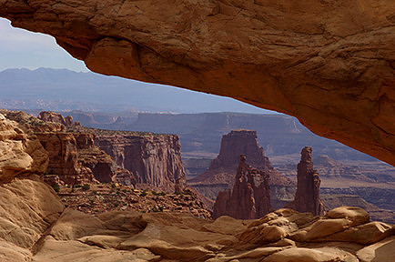
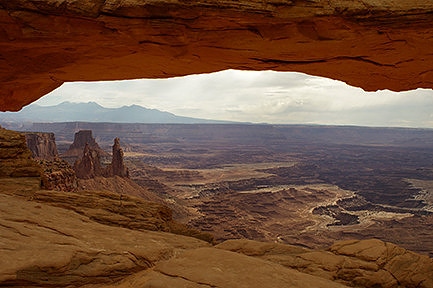
The following morning, my plan was to visit Mesa Arch for sunrise. However, when my alarm went off, I could see that it was pretty much completely overcast, so I decided to sleep in a bit. Eventually, though, I packed up and headed out, driving back into the park. It was an even shorter hike than I'd realized, and there were a lot of folks around, but it was a lot of fun. I worked my way towards the arch very slowly, spending my time wandering among the rocks, looking for interesting compositions. I eventually made it right up to the arch itself and was blown away by just how small it actually was. I had always assumed it was a huge archway from photos I'd seen, just like all the other arches I'd come across. It's amazing how the perspective and lens choice can make things seem far larger (or far smaller) than they truly are. Even though it wasn’t the ‘right’ time of day or with the ‘right’ light, I was still very happy with the photographs I made and was very glad I spent so much time there.
Canyonlands National Park, Utah
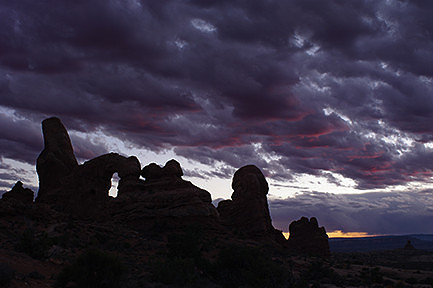
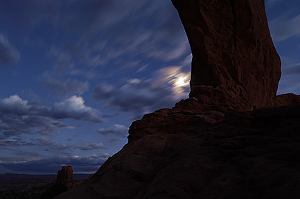
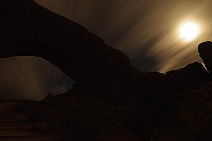
Canyonlands National Park, Utah I stopped at a few more of the overlooks, then headed out of the park for the final time. Once I got closer to town, I checked in with Savory to see how things were going. She was still dealing with everything, so I let her know I was heading over to Arches National Park and would check back again in a couple of days. I was soon at the Visitor Center for Arches and found once again that the single campground was full. I headed into town and booked a room at one of the motels. I spent the next few hours researching the final park and charging up my camera batteries. Around dinnertime, I headed back out to the park to start exploring, hoping to catch a good sunset at one of the arches. Unfortunately, the driving time took a lot longer inside the park than I expected, so by the time I reached the Window arches, the color was just about gone. I hiked out to North Window Arch and got what photos I could of Turret Arch in the remaining color. Then, I wandered around the two arches doing night photography for a few hours. The moon was getting closer and closer to being full, and there were still occasional clouds scudding through the sky, so it made for some really interesting photos, and I had a lot of fun.
Moonrise and streaking clouds over one of the arches. Arches National Park, Utah
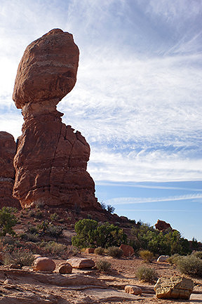
One of the arches under the nearly full moon and streaking clouds in the night sky. Arches National Park, Utah The next morning, I drove back into the park and started checking out all the viewpoints I’d driven past the night before. I stopped for a few photos at Park Avenue Viewpoint but bypassed the La Sal Mountains Viewpoint, as it would have had me shooting straight into the sun. I stopped a few minutes later to pull over for a few telephoto shots of Balanced Rock and one of the Window arches in the distance, before moving on to Courthouse Towers Viewpoint. Again, I only spent a few minutes there getting photos before moving on. Honestly, none of these places were particularly interesting for me, but I wanted to at least get some photos to remember them. After one more quick stop at Petrified Dunes Viewpoint for a long lens shot of the North and South Window Arches, I arrived at my first destination of the day – Balanced Rock. I spent an hour there following the trail as it slowly circled the famous rock. I took a lot of photos from different vantage points, and I can definitely say some were more interesting than others. It was cool, but definitely not as interesting as other stuff I’d seen so far on my trip.
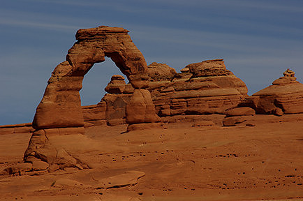
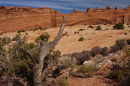
From there, it was on to Delicate Arch, the other famous destination in Arches National Park. There were actually a couple of different vantage points for that particular arch. I have to say that it’s not one of my favorite arches, and I love arches. So, I really didn’t have any desire to do the long trek out to the famous viewpoint. Instead, I went to the less well-known and farther away viewpoint at the end of the road. After a relatively short hike, I climbed atop a large rock and could see the arch in the distance surrounded by hordes of people. While I wasn’t able to get the beautiful mountains as a backdrop for the arch (they were now behind me), I was definitely able to get some interesting photographs, especially since they’re from a viewpoint you don’t usually see. I spent a few hours there working on different compositions, relaxing, and having lunch. I set up my tripod and used different lenses as well as bracketing for focus, exposure, and white balance. I had a good time and definitely think it was the right decision for me.
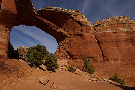
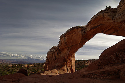
A view of Delicate Arch with my 24-70mm lens from the same location. This gives a better idea of how far I truly was from the famous arch. I really enjoy this photo, as well, with the deadwood appearing to point right to the arch. Arches National Park, Utah After that, I spent a little while photographing a location called Salt Valley Overlook. There were some interesting formations in the distance. Then, I headed on to my next location, Sand Dune Arch and Broken Arch. I was going to hike out to both for some hopefully interesting photographs. There were a lot of folks doing the short hike to Sand Dune Arch. The trail was very narrow and required a bit of scrabbling in places, and of course, it was quite sandy, but it was definitely worth it. At the end of the trail, the ground was nothing but deep sand, as if I were slogging through a dry, sandy beach. The arch itself was a cute little thing in the wall of the small canyon. After that, I retraced my steps, then hiked over to Broken Arch. This trail was longer and crossed the open prairie with far fewer hikers. I spent a lot of time there, getting images from all sides and angles and with various bushes and rock cairns for foreground. I had a blast and would have been quite happy to spend the rest of the day there waiting for sunset, if I weren’t so desperate to see other areas of the park too.
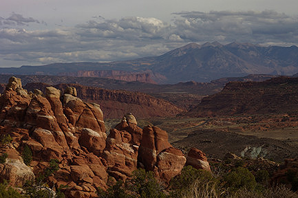
View of the other side of the arch with mountains in the distance. Arches National Park, Utah Eventually, I headed out and continued along the road towards the Devil’s Garden, making a quick stop on the side of the road for a few images of Skyline Arch. Unfortunately, by the time I got to the Devil’s Garden and discovered it would be quite a hike to see anything, I was just too exhausted. There were a lot of arches deep within those stone fins that I wanted to see, but I didn’t have the energy for it. I headed back out and stopped at Fiery Furnace Viewpoint, having bypassed it earlier. There were interesting red and white pinnacles with an amazing backdrop of mountains similar to what folks could see at Delicate Arch. I only spent a few minutes there, but the photo I came away with was one of my favorites of the whole trip. After that, I left the park and headed back to the motel to crash, asleep before the sun even set.
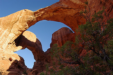
The following morning, I woke up and checked out of the motel early enough to get into the park for sunrise. There was one last arch that I had to see, my absolute favorite, Double Arch. It shared the same parking lot as the Turret and Window arches, but the trail was in the opposite direction. It wasn’t a long hike, though I stopped a lot for photos along the way. The sun was rising behind me, and there wasn’t a cloud in the sky. I wasn’t able to get any amazing sunrise photos, but I did get that early golden light on the arch. It was ok, but I have to admit that I wasn’t that happy with the results or even with the arch itself. I found I’d actually enjoyed some of the other arches more. But, I’m not giving up on Double Arch. I’ve seen some amazing photos of it and definitely want to come back to try again under different circumstances. I know it would be a lot of fun to shoot at night.
After finishing up at Double Arch, I headed back to the car and left Arches National Park behind. I drove northwest through different territory, eventually arriving in Salt Lake City once more. I unloaded the rental, filled it up with gas and returned it to the airport that evening. I spent the rest of my time in Utah visiting with Savory and seeing a little more of the city before returning home. It was unfortunate we hadn’t been able to do as much together as we’d originally planned, but I was glad for the experiences I'd had. I definitely want to come back again to see more of the state, maybe revisit some of those locations, and hopefully be able to do it all with my best friend. |